Slides from 1963
Search This Blog
Friday, July 19, 2013
Tuesday, July 16, 2013
Custer’s Last Stand
Located in southeastern Montana, Little Bighorn Battlefield
National Monument memorializes the site of the Battle of the Little Bighorn
which took place on June 25-26, 1876.
 |
| Photo taken by Jean E. Straatmeyer June 26, 2012 |
It was an overwhelming victory for the Lakota, Northern
Cheyenne and Arapaho tribes led by Crazy Horse, Chief Gall and inspired by the
visions of Sitting Bull.
 |
| Photo from 2012 |
The US 7th Cavalry, including the Custer Battalion led by George Armstrong Custer, suffered a severe defeat.
Sunday, July 14, 2013
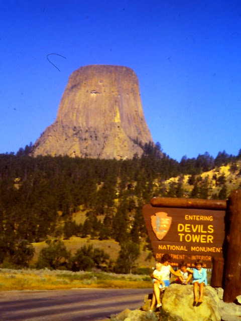
Devils Tower in 1966
We were young.
Going West.
Exploring new vistas.
Enjoying God's creation in Wyoming.
Going West.
Exploring new vistas.
Enjoying God's creation in Wyoming.
Geologists agree that Devils Tower was formed by the intrusion of igneous material, but they cannot agree on exactly how that process took place. Geologists Carpenter and Russell studied Devils Tower in the late 19th century and came to the conclusion that the Tower was formed by an igneous intrusion. Later geologists searched for further explanations. Several geologists believe the molten rock comprising the Tower might not have surfaced; other researchers are convinced the tower is all that remains of what once was a large explosive volcano.
 |
| 35mm photo by H. Gene Straatmeyer |
This is a view of the west face of the tower.
 |
| 35mm photo by H. Gene Straatmeyer |
We walked all around this huge monolith. This is the East face.
Devils Tower in geological context. The oval-shaped mesa around the Tower suggests the old volcano's shape. The red rock is the Permian-Triassic Spearfish Formation, and above that is the younger, white Gypsum Springs Formation. Aerial photo, 2010.
Thanks to Wikipedia for the information and the aerial shot above.
Friday, July 12, 2013
Thursday, July 11, 2013
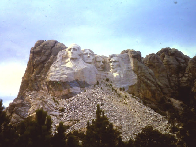
Mt. Rushmore - 44 years of change
In the year 1967 our family took a trip to Mount Rushmore in the South Dakota Black Hills.
In the year 2010, we were privileged to take our two youngest granddaughters to see the same sight.
The only changes I see are a few additional trees. But the build-up of tourist activities is HUGE!
I would even say - overwhelming!
This is where they "herd" the tourists along the way to the viewing station.
A buffalo - just in case any tourist misses the live ones down the road.
Above, is a huge picture of one of the presidential noses. There is a large gallery showing the history of Mt. Rushmore.
This is a depiction of buffalo hide drawings on the wall of a saloon.
Tuesday, July 9, 2013
From Iowa to Alaska in 1970
In 1970
we began our new life in Fairbanks, Alaska.
We left a beautiful open country
setting in Iowa for a great adventure in North Country.
 |
| Colfax Center Presbyterian Church, cemetery and manse in 1970. |
 |
| It is strange how odd furniture looks in the open air instead of in its place in the house. |
 |
|
Here,
Cindee had suffered a bee sting
on the back of her leg and the only mirror
available
to check it out was sitting on the ground beside the church.
|
We had
a huge auction sale where folks came from miles around to get a glimpse of our
stuff. We sold as much as we could and sent the rest by moving van. We waited many weeks for that van to finally reach Fairbanks.
We made the trip in a 2-door Ford LTD. We thought it would be safer for our kids than a 4-door. That
was before seat belts, so our two girls each picked a side in the back seat
while Mike bounced back and forth, many times stretching out on the back ledge.
We traveled slowly and carefully on those 1100 miles of gravel roads.
Eventually,
after ten days of travel, on September 29, 1970, we drove into Fairbanks.
There was snow on the streets, the lawns, the houses and everywhere. We didn’t
see the bare ground or the streets again until perhaps April. These pictures
show how the snow piles up higher and higher. In those days, it was unheard of
to have a wind storm or blizzard in Fairbanks.
The
church (instead of being in the open country) was located
right in the heart of the city. We spent nearly eight years learning to love Alaska so
much that when we left, we said we’d be back.
And we were! It took twelve years.

The Julien Dubuque Monument
On one of our many trips to Dubuque, Iowa
this picture was captured.
1965
The
Julien Dubuque Monument stands on the edge of the bluff above Catfish Creek in
the Mines of Spain Recreation Area.
Julien Dubuque married Potosa, daughter of Peosta, the chief of the Mesquakie Indians. Dubuque died in March of 1810 and when he died the Mesquakie buried him with tribal honors beneath a log mausoleum at the site of the current monument. The Julien Dubuque monument was built in 1897 and sits high above the Mississippi River. It overlooks the Mines of Spain property in the town that would eventually bear his name.
The information above was gleaned from the City of Dubuque website:
http://www.cityofdubuque.org/index.aspx?NID=706
Monday, July 8, 2013
Christmas Morning
Subscribe to:
Comments (Atom)


